CLI
Script catalogs and manifest-as-code from your terminal. Installs the geolens command.
pip install geolens-cli Search & Discover
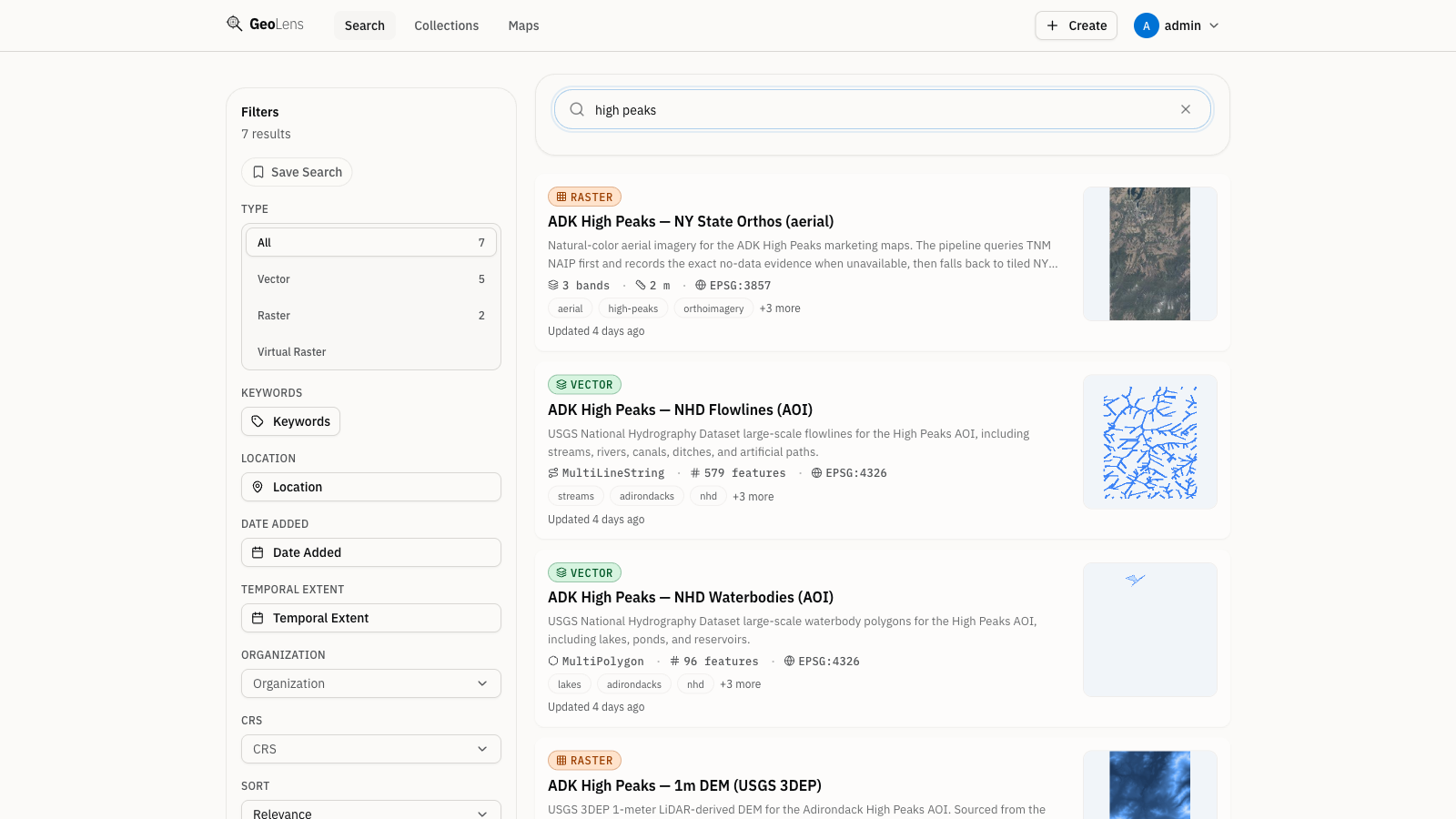
Search across your entire GeoLens catalog by name and description — and, when an embedding provider is configured, by semantic meaning. Filter by geometry type - vector, raster, or table - and preview datasets on a map before you export.
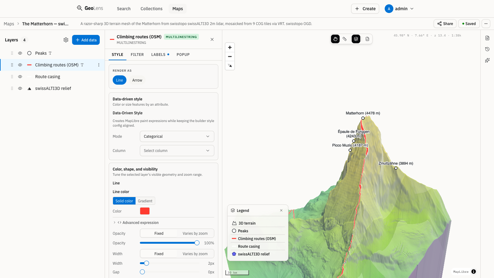
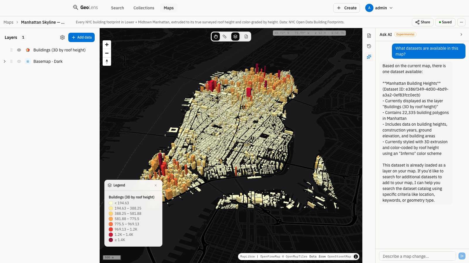
Create & Share Maps
Combine vector and raster datasets from your catalog with point-and-click layer controls. Pick basemaps, reorder layers, adjust styling, and publish a shareable map URL without writing SQL or leaving the browser.
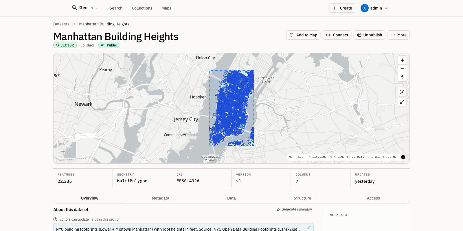
Ingest Any Format
Drop a GeoJSON, Shapefile, GeoPackage, CSV, or OGC service URL and GeoLens handles validation, CRS inspection, column sampling, and catalog indexing automatically. Metadata fills in from the file; you just click publish.
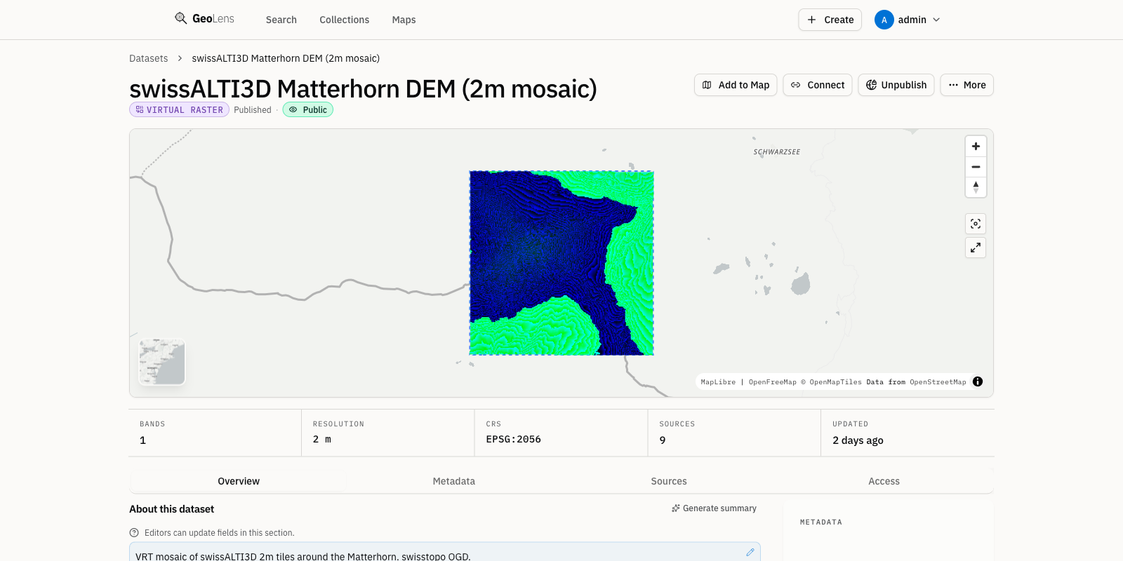
Raster & VRT Mosaics
Stitch multiple Cloud-Optimized GeoTIFFs into a single VRT mosaic, then serve raster tiles via Titiler — with band selection, colormaps, and min/max stretch controls, plus a direct COG download from the dataset page.
AI-Assisted Exploration
Configure any OpenAI or Anthropic key and chat directly with your GeoLens catalog. Ask which datasets cover a region, request a filtered layer, or explore spatial relationships with natural language.
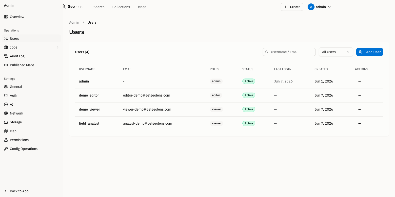
Role-Based Access Control
Assign roles, approve or reject users, and scope dataset visibility per dataset. GeoLens ships with admin, editor, and viewer roles plus JWT-based sessions and OAuth (Google, Microsoft, OIDC).
Programmability
Everything you do in the UI is scriptable. Drive catalogs, datasets, and maps from the command line or your own code — define a catalog as a manifest, commit it to version control, and apply it in CI. The CLI and SDKs talk to the same open APIs.
Script catalogs and manifest-as-code from your terminal. Installs the geolens command.
pip install geolens-cli Build pipelines and integrations in Python against the full GeoLens API.
pip install geolens Embed GeoLens in JavaScript and TypeScript apps with a typed client.
npm install @geolens/sdk Standards & Conformance
GeoLens is standards-first: OGC API Features and Records with CQL2, plus STAC and DCAT 3 metadata — so every dataset is reachable by any spec-compliant client and your catalog travels in open formats. The Features and Records APIs return the conformance classes below at /conformance.
Read and filter geospatial features by attribute, geometry, and CQL2 expressions. Part 1 (Core) plus Part 3 (Filtering).
Discover datasets and records via OGC-standard catalog queries - browse collections, filter by metadata, and retrieve individual records as JSON.